
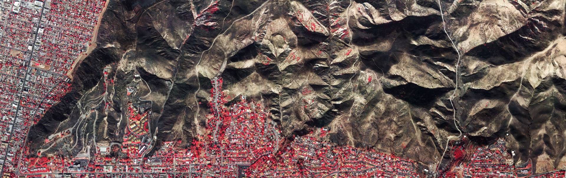
We have begun acquiring imagery of the burn areas from the Thomas Fire in Ventura and Santa Barbara Counties. We are shooting both natural color and color-infrared imagery of the developed areas impacted by this fire. This imagery is geo-referenced and ortho-rectified for use in any GIS or CAD application.
Click on the link below to inquire about this imagery and the areas we plan on photographing. We can add additional area to this plan if needed.
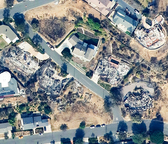
Click for more information about this imagery.
Focal Flight, LLC
226 West Ojai Avenue
Suite 101-173
Ojai, CA 93023-2406
(805) 630-0065
(805) 585-3710 Fax